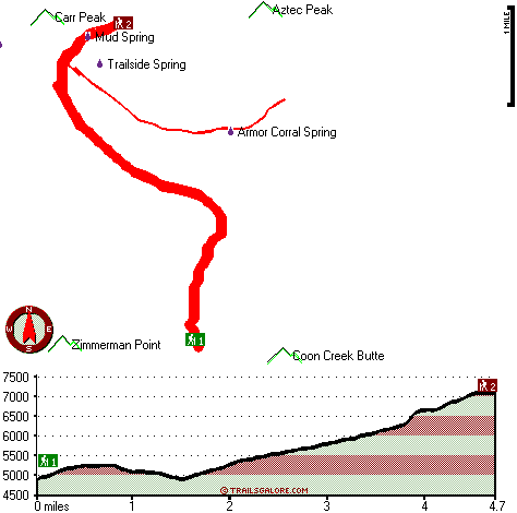
Coon Spring Trail Map
Coon Spring Trail main page
Zoom out if you can't see the trail on the map
Location of Trailhead 1: Latitude 33.7648, Longitude -110.915
Location of Trailhead 2: Latitude 33.8104, Longitude -110.9255
High quality water resistant topo map of Coon Spring Trail, Mogollon Rim Mountains, Gila County, Arizona.
Copyright © Stratus-Pikpuk, Inc.