| |
The distance came up as 3.2mi (or 4.6k) on our map. That was to the River. Nice hike. Says Hope
I just hiked half of this trail on January 20,2008. It's a beautiful quiet trail thru lush forest. Trailhead is difficult to find. From Route 101 in Forks take FR 29. After 11.3 mi take a right onto FR 2913 for 2.2 mi to the end where the trail starts. Says Frank Murphy
This is a one trailhead wilderness trail, so in and out is the way to hike it normally. The total elevation difference for Rugged Ridge Trail is 407 feet which is lower than average. You should count on this backcountry trek taking about 4 hours, but of course some folks walk a bit slower and some a bit faster. The hiking trail stays roughly within the same elevation zone the whole time which means the conditions are about the same from start to finish. Even though this is not a very long wilderness trail you should still bring some emergency supplies just in case something happens. Being 4.6 miles long it's a mid length hike.
|
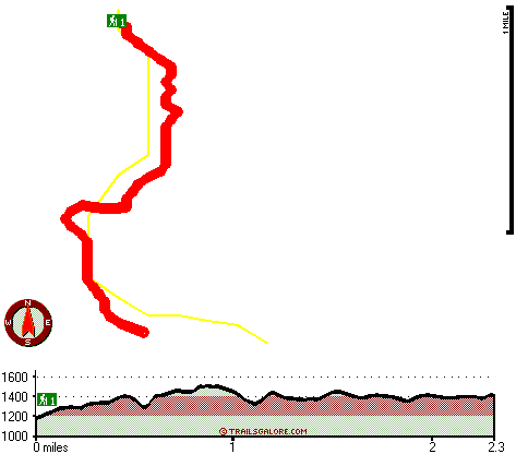
Total in and out hiking length = 4.6 miles
Total climbing distance = 2.1 miles
Difficulty : Medium
Casual Hiking Pace:
4 hours
Fast Hiking Pace:
2.5 hours
Total elevation difference: 407 feet
|


