| |
The total elevation difference for North Fork Tieton Trail is 2,100 feet which is an average number. There is only one trailhead, so in and out is the way to trek it normally. Some parts of this hiking trail are much higher up than other parts of the hiking trail which of course means you need to be prepared for different conditions on different parts of the hiking trail. Now this backcountry trail is pretty long, so make sure you bring plenty of supplies. This backcountry trek should take you about 2 days, so better have big a backpack to fit all the stuff you need. North Fork Tieton Trail is 13.8 miles long; it's a long hiking trail.
|
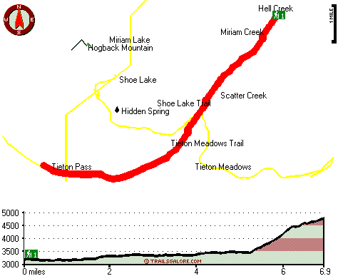
Total in and out hiking length = 13.8 miles
Total climbing distance = 5.1 miles
Difficulty : Difficult
Casual Hiking Pace:
2 days
Fast Hiking Pace:
7.5 hours
Total elevation difference: 2100 feet
|


