| |
The total elevation difference for this trail is 663 feet, and that is lower than average. Rock Creek Trail stays roughly within the same elevation zone the whole time which means the conditions are about the same from start to finish. This region does get very dry sometimes, so don’t forget to check for any current fire restrictions before you go. This backcountry trek shouldn't take more than 4 hours, but you never know stuff could go wrong and you could get stuck so be prepared for that. Rock Creek Trail is 4.6 miles long it's a mid length hike. Even though this is not a very long great outdoors hiking trail it's always good to bring some emergency supplies, you never know what could happen. There is only one trailhead, so you're looking at an in and out backcountry hike.
|
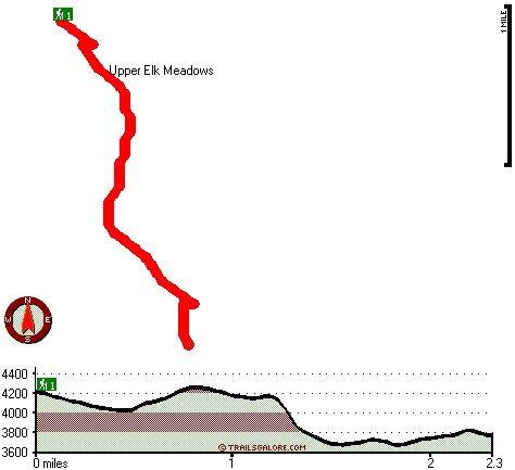
Total in and out hiking length = 4.6 miles
Total climbing distance = 2 miles
Difficulty : Medium
Casual Hiking Pace:
4 hours
Fast Hiking Pace:
2.5 hours
Total elevation difference: 663 feet
|


