| |
Pocket Way is a one trailhead trail, so in and out is the way to trek it normally. This trail has a total elevation difference of 166 feet which is lower than average. This hiking trail is not that long but it's always nice to bring some emergency supplies, you never know what could happen. Pocket Way stays roughly within the same elevation zone the whole time, so you get pretty much the same conditions along the whole backcountry trail. With its 3.2 miles of walking distance it's a short backcountry trail. At parts of the year this vicinity sees very little rain, so do check for current fire restrictions before you go if you plan to bring a stove or make a camp fire. You should count on this backcountry hike taking about 3 hours, but of course some people walk a bit slower and some a bit faster.
|
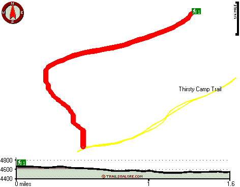
Total in and out hiking length = 3.2 miles
Total climbing distance = 1.3 miles
Difficulty : Medium
Casual Hiking Pace:
3 hours
Fast Hiking Pace:
2 hours
Total elevation difference: 166 feet
|


