| |
Tomales Point Trail stays roughly within the same elevation zone the whole time which means the conditions are about the same from start to finish. This is a hiking and backpacking trail that is quite long, so make sure you bring plenty of supplies. This backcountry trail has only one trailhead, so you're looking at an in and out backcountry trek. This region does get very dry sometimes, so make sure you check current conditions and fire restrictions with local forest authorities before you head out. Being 6.2 miles long it's a mid length backcountry trek. This backcountry trail has a total elevation difference of 447 feet, and that is lower than average. The time needed for this hike is roughly 5.5 hours, but you never know stuff could go wrong and you could get stuck so be prepared for that.
|
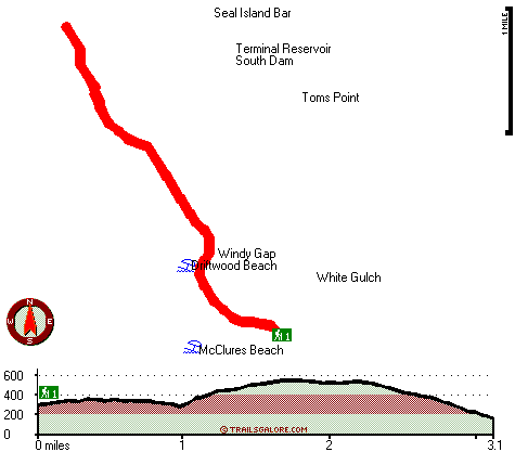
Total in and out hiking length = 6.2 miles
Total climbing distance = 2.8 miles
Difficulty : Difficult
Casual Hiking Pace:
5.5 hours
Fast Hiking Pace:
3.5 hours
Total elevation difference: 447 feet
|


