| |
There is only one trailhead, so you'll be trekking it in and back out. The total elevation difference for Sherwin Lakes Trail is 954 feet, and that is lower than average. This wilderness trail sometimes gets very dry, so don’t forget to check for any current fire restrictions before you go. You should count on this backcountry trek taking about 3 hours, but of course some folks walk a bit slower and some a bit faster. Being 3.4 miles long it's a shorter type walk. Sherwin Lakes Trail stays roughly within the same elevation zone the whole time, so you won’t have to worry about different climate zones along your walk. This is not a very long wilderness trail but it's always nice to bring some emergency supplies, you never know what could happen.
|
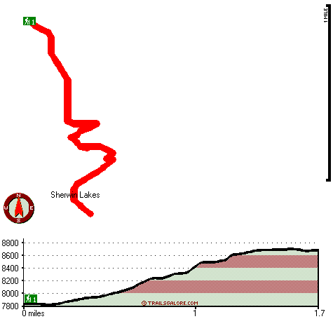
Total in and out hiking length = 3.4 miles
Total climbing distance = 1.3 miles
Difficulty : Medium
Casual Hiking Pace:
3 hours
Fast Hiking Pace:
2 hours
Total elevation difference: 954 feet
|


