| |
Glacier Lakes Trail has a total elevation difference of 559 feet which is lower than average. Glacier Lakes Trail is 4.1 miles long it's an average length backpacking trail. Sometimes this great outdoors trail gets really dry, so do check for current fire restrictions before you go if you plan to bring a stove or make a camp fire. You spend the whole walk in roughly the same elevation zone which means the conditions are about the same from start to finish. This great outdoors trail is not that long but it's always splendid to bring some emergency supplies, you never know what could happen. The time needed for this walk is roughly 3.5 hours, but of course some folks walk a bit slower and some a bit faster.
|
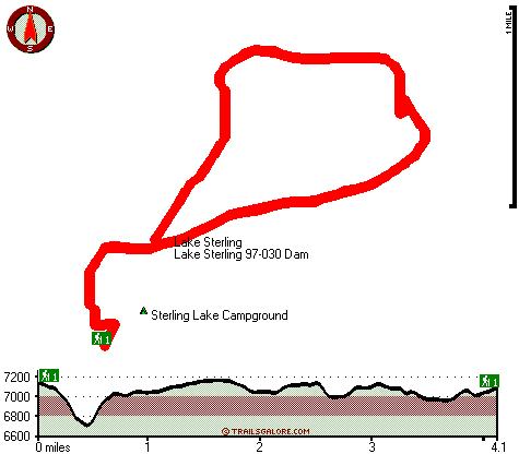
Total hiking length = 4.1 miles
Total climbing distance = 1.9 miles
Difficulty : Medium
Casual Hiking Pace:
3.5 hours
Fast Hiking Pace:
2 hours
Total elevation difference: 559 feet
|


