| |
Fredalba Trail has a total elevation difference of 2,416 feet which is about average. This hiking trail goes through some very different elevations which of course means you need to be prepared for different conditions on different parts of the hiking trail. Fredalba Trail is not that long but you should still bring some emergency supplies just in case something happens. This wilderness trail has only one trailhead, so in and out is the way to walk it normally. Fredalba Trail is 5 miles long it's a mid length backcountry hike. You should count on this walk taking about 4.5 hours, but of course some folks walk a bit slower and some a bit faster. Sometimes this backcountry trail gets really dry, so don’t forget to check for any current fire restrictions before you go.
|
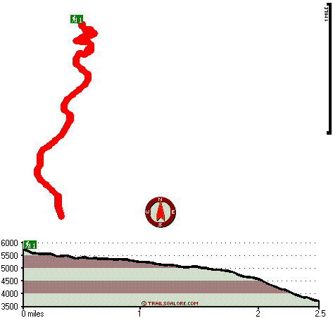
Total in and out hiking length = 5 miles
Total climbing distance = 2 miles
Difficulty : Medium
Casual Hiking Pace:
4.5 hours
Fast Hiking Pace:
3 hours
Total elevation difference: 2416 feet
|


