| |
The total elevation difference for Twin Peaks Trail is 2,992 feet, and that is higher than average. Sometimes this trail gets really dry, so don’t forget to check for any current fire restrictions before you go. With its 10.2 miles of walking distance; it's considered a longer backcountry trek. This backcountry hiking trail goes through some very different elevations which of course means you need to be prepared for different conditions on different parts of the backcountry hiking trail. Now, this is roughly a 1.5-day backcountry walk, so better have big a backpack to fit all the stuff you need. This is a trail that is quite long, so make sure you bring plenty of supplies.
|
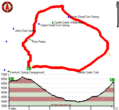
Total hiking length = 10.2 miles
Total climbing distance = 4.7 miles
Difficulty : Difficult
Casual Hiking Pace:
1.5 days
Fast Hiking Pace:
5 hours
Total elevation difference: 2992 feet
|


