| |
Tanner Trail is 9 miles one way---NOT 6.4 miles as this article states. Huge difference. The S. Kaibab Trail is 6.5 miles one way--and Tanner is so much longer. I've done Tanner many times, it is tough but lots of solitude, especially in summer... Says LENNIE LEFLER
The total elevation difference for Tanner Trail is 4,932 feet which is higher than average. Different parts of this hiking trail are at very different elevations, and that means that some parts of the hiking trail could be very different from other parts of it. This trek should take you about 2 days, so it's a good thing if your backpack is big enough to do the job. This is a one trailhead great outdoors trail, so you'll be backcountry hiking it in and back out. At parts of the year this region sees very little rain, so do check for current fire restrictions before you go if you plan to bring a stove or make a camp fire. Being 12.8 miles long; it's considered a longer trek. Now this backpacking and hiking trail is pretty long, so make sure you bring plenty of supplies.
|
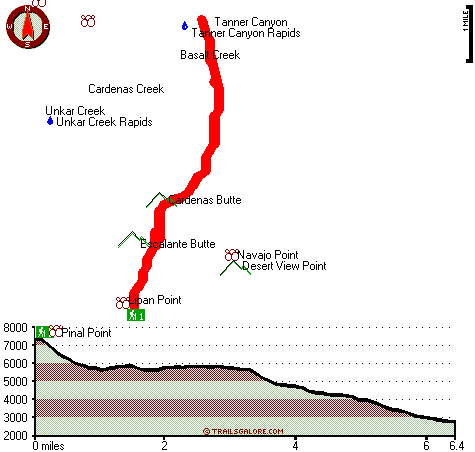
Total in and out hiking length = 12.8 miles
Total climbing distance = 4.9 miles
Difficulty : Difficult
Casual Hiking Pace:
2 days
Fast Hiking Pace:
7 hours
Total elevation difference: 4932 feet
|


