| |
The total elevation difference for Sweetwater Trail is 1,136 feet which is an average number. This is a one trailhead backcountry trail, so you're looking at an in and out backcountry walk. With its 5.4 miles of walking distance it's an average length backpacking and hiking trail. There's not much difference in elevation along the backpacking and hiking trail, so you get pretty much the same conditions along the whole backpacking and hiking trail. At parts of the year this vicinity sees very little rain, so make sure you check current conditions and fire restrictions with local forest authorities before you head out. You should count on this backcountry walk taking about 5 hours, but of course some folks walk a bit slower and some a bit faster. This hiking trail is not that long but you should still bring some emergency supplies just in case something happens.
|
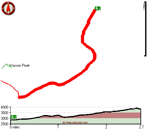
Total in and out hiking length = 5.4 miles
Total climbing distance = 2.4 miles
Difficulty : Medium
Casual Hiking Pace:
5 hours
Fast Hiking Pace:
3 hours
Total elevation difference: 1136 feet
|


