| |
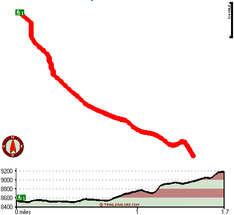
There is only one trailhead, so in and out is the way to walk it normally. Miller Peak Trail stays roughly within the same elevation zone the whole time which means the conditions are about the same from start to finish. Miller Peak Trail is not that long but you should still bring some emergency supplies just in case something happens. With its 3.4 miles of walking distance it's shorter than many backpacking and hiking trails. At parts of the year this area sees very little rain, so make sure you check current conditions and fire restrictions with local forest authorities before you head out. The time needed for this backcountry hike is roughly 3 hours, but of course some people walk a bit slower and some a bit faster. Miller Peak Trail has a total elevation difference of 781 feet which is a lower than average number.
|
Total in and out hiking length = 3.4 miles
Total climbing distance = 1.3 miles
Difficulty : Medium
Casual Hiking Pace:
3 hours
Fast Hiking Pace:
2 hours
Total elevation difference: 781 feet
|


