| |
The total elevation difference for Dome Trail is 2,127 feet, and that is about average. At parts of the year this region sees very little rain, so do check for current fire restrictions before you go if you plan to bring a stove or make a camp fire. Being 25.2 miles long; it's longer than many backcountry hiking trails. This wilderness trail has only one trailhead, so you'll be hiking it in and back out. Now this wilderness trail is pretty long, so don't forget to pack enough supplies. Different parts of this backcountry hiking trail are at very different elevations which of course means you need to be prepared for different conditions on different parts of the backcountry hiking trail. Now, this is roughly a 4-day backcountry trek, so better have big a backpack to fit all the stuff you need.
|
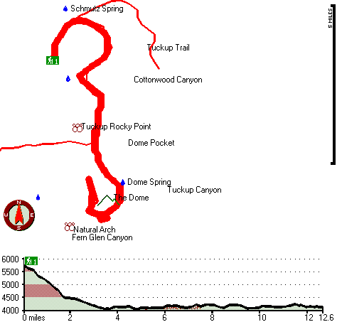
Total in and out hiking length = 25.2 miles
Total climbing distance = 10.9 miles
Difficulty : Difficult
Casual Hiking Pace:
4 days
Fast Hiking Pace:
2.5 days
Total elevation difference: 2127 feet
|


