| |
Does anyone have any info about this trail. I'd love to know more about it. Says Anonymous
There is only one trailhead, so you'll be trekking it in and back out. The total elevation difference for Black Rock Trail is 1,142 feet, and that is about average. With its 3.2 miles of walking distance it's a shorter type backcountry trek. This backcountry walk shouldn't take more than 2.5 hours, but of course some folks walk a bit slower and some a bit faster. There's not much difference in elevation along the hiking trail which means the conditions are about the same from start to finish. At parts of the year this area sees very little rain, so don’t forget to check for any current fire restrictions before you go. Even though this is not a very long wilderness trail you should still bring some emergency supplies just in case something happens.
|
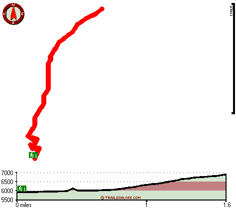
Total in and out hiking length = 3.2 miles
Total climbing distance = 1.2 miles
Difficulty : Medium
Casual Hiking Pace:
2.5 hours
Fast Hiking Pace:
1.5 hours
Total elevation difference: 1142 feet
|


