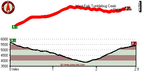
McGowan Mountain Way Map
McGowan Mountain Way main page
Zoom out if you can't see the trail on the map
Location of Trailhead 1: Latitude 43.4312, Longitude -122.2699
Location of Trailhead 2: Latitude 43.4373, Longitude -122.2332
High quality water resistant topo map of McGowan Mountain Way, Central Cascade Range, Douglas County, Oregon.
Copyright © Stratus-Pikpuk, Inc.