Dinner Ridge Way Map
Dinner Ridge Way main page
Zoom out if you can't see the trail on the map
Location of Trailhead 1: Latitude 43.6689, Longitude -122.4353
Location of Trailhead 2: Latitude 43.6675, Longitude -122.5733
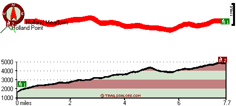
High quality water resistant topo map of Dinner Ridge Way, Central Cascade Range, Lane County, Oregon.
Copyright © Stratus-Pikpuk, Inc.