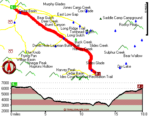
South Fork Cottonwood Trail Map
South Fork Cottonwood Trail main page
Zoom out if you can't see the trail on the map
Location of Trailhead 1: Latitude 40.1906, Longitude -122.9918
Location of Trailhead 2: Latitude 40.045, Longitude -122.8073
High quality water resistant topo map of South Fork Cottonwood Trail, Klamath Mountains, Tehama County, California.
Copyright © Stratus-Pikpuk, Inc.