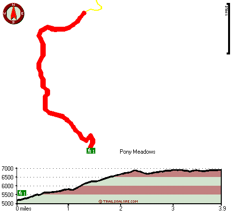
Smoke Howe Trail Map
Smoke Howe Trail main page
Zoom out if you can't see the trail on the map
Location of Trailhead: Latitude 39.9565, Longitude -122.9596
High quality water resistant topo map of Smoke Howe Trail, Klamath Mountains, Trinity County, California.
Copyright © Stratus-Pikpuk, Inc.