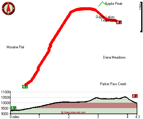
Gaylor Lakes Trail Map
Gaylor Lakes Trail main page
Zoom out if you can't see the trail on the map
Location of Trailhead 1: Latitude 37.8793, Longitude -119.3026
Location of Trailhead 2: Latitude 37.9102, Longitude -119.2574
High quality water resistant topo map of Gaylor Lakes Trail, Central Sierra Nevada, Tuolumne County, California.
Copyright © Stratus-Pikpuk, Inc.