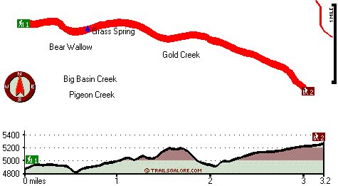
Cone Point Trail Map
Cone Point Trail main page
Zoom out if you can't see the trail on the map
Location of Trailhead 1: Latitude 41.1788, Longitude -121.998
Location of Trailhead 2: Latitude 41.1664, Longitude -121.9462
High quality water resistant topo map of Cone Point Trail, Southern Cascade Range, Shasta County, California.
Copyright © Stratus-Pikpuk, Inc.