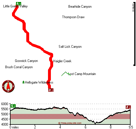
Hells Gate Trail Map
Hells Gate Trail main page
Zoom out if you can't see the trail on the map
Location of Trailhead 1: Latitude 34.2804, Longitude -111.1337
Location of Trailhead 2: Latitude 34.1822, Longitude -111.0972
High quality water resistant topo map of Hells Gate Trail, Mogollon Rim Mountains, Gila County, Arizona.
Copyright © Stratus-Pikpuk, Inc.