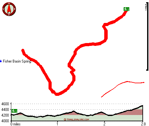
Fisher Basin Trail Sixty four Map
Fisher Basin Trail Sixty four main page
Zoom out if you can't see the trail on the map
Location of Trailhead: Latitude 32.9452, Longitude -110.2095
High quality water resistant topo map of Fisher Basin Trail Sixty four, Graham County, Arizona.
Copyright © Stratus-Pikpuk, Inc.