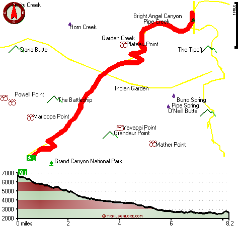
Bright Angel Trail Map
Bright Angel Trail main page
Zoom out if you can't see the trail on the map
Location of Trailhead: Latitude 36.0572, Longitude -112.1455
High quality water resistant topo map of Bright Angel Trail, Coconino County, Arizona.
Copyright © Stratus-Pikpuk, Inc.