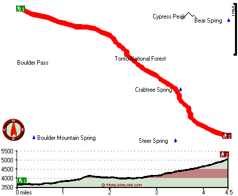
Boulder Creek Trail Map
Boulder Creek Trail main page
Zoom out if you can't see the trail on the map
Location of Trailhead 1: Latitude 33.8471, Longitude -111.442
Location of Trailhead 2: Latitude 33.8119, Longitude -111.385
High quality water resistant topo map of Boulder Creek Trail, Mogollon Rim Mountains, Maricopa County, Arizona.
Copyright © Stratus-Pikpuk, Inc.